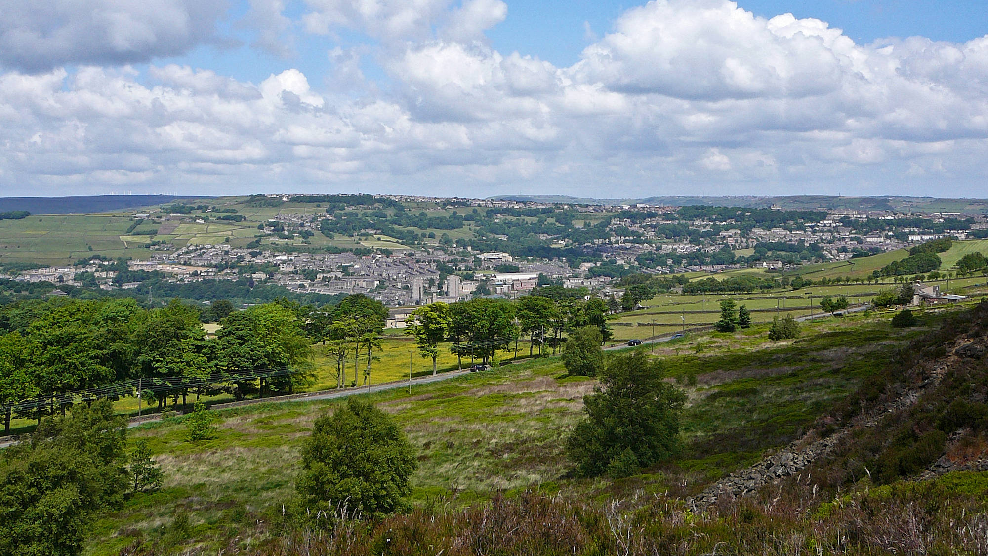
From a short 1.25-mile stroll to a 9.3-mile hike, here’s our guide to the best woodland walks in West Yorkshire.
Whether you’re after a sedate family stroll or a leg-stretching hike through ancient oaks, the region is packed with leafy escapes. From the craggy heights of Otley to the hidden valleys of Calderdale, we’ve rounded up 10 of the best woodland walks to help you reconnect with nature. Here’s where to find incredible views, historic landmarks and the finest canopy cover in the county. We’ve arranged it in order of walk length, so if you’re looking for a shorter walk, start at the beginning. If it’s a hike you’re after, you’ll find them nearer the end.
The scenic 1.25-mile Mill Walk will take you on a colourful romp through the woods. You’ll start at the Midgehole car park before following the trail down along the tree-lined path to the river, which you’ll take all the way to Gibson Mill.
The route is easy-going most of the way, with occasional clambering, and an uphill stint as you head back up through the top woods and back to the car park where you began. Along the way, you’ll see the famous Slurring Rock and be treated to incredible views.
Start point: Midgehole Car Park – find it on Google Maps Distance: 1.25 miles Difficulty: Easy Know before you go: The car park can get extremely busy at weekends. It’s worth parking at Clough Hole instead, which is a 15-minute walk away. Route:Check out the route
Nostell Obelisk Walk
If you’re looking for quick and easy woodland walks in West Yorkshire, make a beeline for National Trust property Nostell Priory, in Wakefield. The 2-mile Obelisk Walk is perfect for ramblers of all abilities and shows off the beauty of this historic estate in just one hour.
Start at the Palladian House which dates back to 1733, then seek out the Boathouse next to the lake that shares its name. The Obelisk Lodge, the estate’s original gatehouse which was lived in until the 1950s, is up next before you cross Boathouse Bridge and head back to the Stable Courtyard.
Start point: Nostell Priory courtyard – find it on Google Maps Distance: 2 miles Difficulty: Easy Know before you go: It’s a National Trust property and the car park is £5 per car – or free for members. Route:Check out the route
Otley Chevin
Credit: Leeds-List
The Otley Chevin is home to some of the best woodland walks in West Yorkshire and the Surprise View route is right up there. It’s only 2.7 miles long, but it’s not all plain sailing – there’s a fair bit of climbing to do.
You’ll delve into the deep woods of oak and beech past Yorkgate Quarry and through the Chevin Forest Nature Reserve to reach the top. Once there, you’ll be richly rewarded – see if you can spot Simon’s Seat and Almscliffe Crag in the distance before you take the clifftop path and head through the woods to finish.
Start point: Otley Chevin – find it on Google Maps Distance: 2.7 miles Difficulty: Easy Know before you go: It’s a great walk for families and you’ll find an ice cream van on the route in summer – but it’s not suitable for pushchairs. Route:Check out the route
Easter Gate Return
At only 2.8 miles long, the Easter Gate Return is a woodland walk fit for all the family. You’ll start at The Old Goods Yard in the heart of Marsden before following the canal towpath to Lock 42E where a big red way marker signals your next stage.
You’ll head left at Standedge Tunnel into thick, lush woodland that leads you along bridleways up to the ancient Easter Gate packhorse bridge. Cross the 300-year-old bridge and head into more woods before you rejoin the canal path that leads you back into Marsden.
Start point: Marsden Moor – find it on Google Maps Distance: 2.8 miles Difficulty: Easy Know before you go: It can get very windy up on the moor so bring layers, even on a sunny day. Route:Check out the route
Elland Park Wood offers a relaxing 4-mile jaunt through a quiet stretch of greenery. Start at Park Road car park, heading along a track that takes you right into the trees. You’ll head straight through the trees until you reach the vibrant carpets of bluebells that emerge each spring. During these months, the air is filled with the unmistakable scent of wild garlic, leading you toward the old red-brick cobbled road.
It leads you to the Calderdale Way to take you back to the start, or you can carry on your trek for an extra couple of miles to Cromwell Bottom Nature Reserve.
Start point: Park Road – find it on Google Maps Distance: 4 miles Difficulty: Easy Know before you go: Looking for somewhere to ride your mountain bike? Elland Park Wood has mountain bike trails too – be warned though, they’re not for the faint-hearted. Route:Check out the route
The Luddenden Dean and the Calderdale Way is a fairly easygoing 6.5-mile walk through one of the most under-appreciated walking spots in West Yorkshire. You’ll start at Station Road car park, heading north following Luddenden Brook until you reach Jerusalem Farm.
Then it’s into the pretty Wade Wood Nature Reserve and along the Calderdale Way until you make your way through Upper Heys Wood, a charming deciduous forest. You’ll pass fields, farms and streams before you rejoin the footpaths that take you back to the start.
Start point: Station Road car park – find it on Google Maps Distance: 6.5 miles Difficulty: Easy/moderate Know before you go: Wade Wood Nature Reserve is the perfect place for bird spotting and if you’re lucky you might even see deer. Route:Check out the route
This gorgeous 6.7-mile jaunt around north-west Leeds starts exactly where you want it to – in the woods! Hawksworth Wood is just across the road from Kirkstall Abbey and offers one of the best woodland walks in West Yorkshire.
It’s jam-packed full of trees and home to all kinds of wildlife, so keep an eye out as you take the riverside paths along the Aire and towards Newlay Bridge. You’ll then join the Leeds & Liverpool Canal towpath to Calverley Bridge, before passing through the leafy Hunger Hills, Haigh Wood and Oil Mill Beck to the start.
Start point:Hawksworth Road – check it on Google Maps Distance: 6.7 miles Difficulty: Moderate Know before you go: Keep an eye out in Hawksworth Wood for the metal hatch entrance to an old explosive store which housed the TNT used to quarry the stone. Route:Check out the route
Hetchell Wood Circular
Head to Thorner Village for a 7.7-mile walk that takes you into Hetchell Wood. You’ll kick things off at St Peter’s Church before making your way across Thorner Moor along easy-to-follow tracks – why not pause to enjoy the stunning views over the Bramham Park Estate?
It’s onward to Stubbing Moor and Wothersome Lake before you reach Hetchell Wood Nature Reserve, where you can wander through the towering trees and spot local wildlife. Fancy a longer walk? Explore the Pompocali Earthworks, just around the corner.
Start point: St Peter’s Church – find it on Google Maps Distance: 7.7 miles Difficulty: Moderate Know before you go: If you’re into botany, you’ll be interested to know that Hetchell Wood is home to an unusual plant only found at a handful of sites in Yorkshire – thistle broomrape. Route:Check out the route
The Sicklinghall Circular is an 8.6-mile circular route around some of the most beautiful, wooded areas of West Yorkshire. It’s challenging, but still rewarding as you start at the village pond, before taking the abandoned railway line in the direction of Stockeld Park.
From here, you’ll nip through the woods and onto The Harland Way towards Wetherby. Stroll along beside the River Wharfe before you make a beeline through the golf course at Linton and meander through the ever-so-pretty Lime Kiln Woods on your way back to the start.
Start point: Sicklinghall Pond – find it on Google Maps Distance: 8.6 miles Difficulty: Moderate Know before you go: Bear in mind sections of this walk can get extremely muddy, so dress accordingly. Route:Check out the route
If you fancy a long, sprawling, woodland walk with a steady incline, try the North Dean Woods and Norland Circular. This 9.3-mile route starts at Brig Royd Car Park in Halifax, but you’ll soon leave the urban jungle behind for an unspoiled wander.
You’ll head along one side of the River Calder before crossing to the other, still heading north, until you reach Hollas Lane. You’ll then venture up towards the heather-covered moors of Norland and into the thick North Dean Woods, rich in old oak and birch trees, before you reach the riverside path that leads you back to the start.
Start point: Brig Royd Car Park – find it on Google Maps Distance: 9.3 miles Difficulty: Moderate/hard Know before you go: North Dean Woods and Norland Circular are close to the start of the 50-mile Calderdale Way. Route:Check out the route
Prices and timings were verified as correct at the time of publishing in May 2026. Please check venue websites for the latest opening times and parking charges before you set off.
Fiona Kyle is a Senior Writer at Yorkshire-List with over 25 years’ experience in regional journalism and lifestyle writing. Originally from West Yorkshire and now based in North Yorkshire, she specialises in things to do in Yorkshire, including the best restaurants in Leeds, places to visit in York, and independent hospitality across the region. Fiona has written for publications including Yorkshire Evening Post and Leeds Live, and is known for personally visiting and reviewing venues to provide honest, experience-led recommendations. Her work helps readers discover trusted local businesses and authentic Yorkshire experiences. More from Fiona Kyle